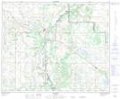
Maps showing Fish Lake, 2-43-10-W4, Alberta
Fish Lake is a Lake located in 2-43-10-W4, Alberta and has an elevation of 625 meters.
- Latitude: 52° 40' 46'' North (decimal: 52.6794444)
- Longitude: 111° 21' 20'' West (decimal: -111.3555555)
- Topography Feature Category: Lake
- Geographical Feature: Lake
- Canadian Province/Territory: Alberta
- Elevation: 625 meters
- Location: 2-43-10-W4
- Atlas of Canada Locator Map: Fish Lake
- GPS Coordinate Locator Map: Fish Lake Lat/Long
Fish Lake NTS Map Sheets