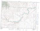
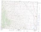
Maps showing Five Mile Creek, 9-29-W4, Alberta
Five Mile Creek is a River located in 9-29-W4, Alberta and has an elevation of 1259 meters.
- Latitude: 49° 43' 23'' North (decimal: 49.7230555)
- Longitude: 113° 50' 59'' West (decimal: -113.8497222)
- Topography Feature Category: River
- Geographical Feature: Creek
- Canadian Province/Territory: Alberta
- Elevation: 1259 meters
- Location: 9-29-W4
- Atlas of Canada Locator Map: Five Mile Creek
- GPS Coordinate Locator Map: Five Mile Creek Lat/Long
Five Mile Creek NTS Map Sheets