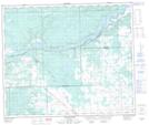
Maps showing Five Mile Island, 60-8-W5, Alberta
Five Mile Island is a Island located in 60-8-W5, Alberta and has an elevation of 637 meters.
- Latitude: 54° 12' 12'' North (decimal: 54.2033333)
- Longitude: 115° 6' 27'' West (decimal: -115.1074999)
- Topography Feature Category: Island
- Geographical Feature: Island
- Canadian Province/Territory: Alberta
- Elevation: 637 meters
- Location: 60-8-W5
- Atlas of Canada Locator Map: Five Mile Island
- GPS Coordinate Locator Map: Five Mile Island Lat/Long
Five Mile Island NTS Map Sheets