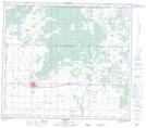
Maps showing Ketchum Lake, 13-82-3-W6, Alberta
Ketchum Lake is a Lake located in 13-82-3-W6, Alberta and has an elevation of 685 meters.
- Latitude: 56° 6' 24'' North (decimal: 56.1066666)
- Longitude: 118° 19' 27'' West (decimal: -118.3241667)
- Topography Feature Category: Lake
- Geographical Feature: Lake
- Canadian Province/Territory: Alberta
- Elevation: 685 meters
- Location: 13-82-3-W6
- Atlas of Canada Locator Map: Ketchum Lake
- GPS Coordinate Locator Map: Ketchum Lake Lat/Long
Ketchum Lake NTS Map Sheets