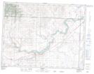
Maps showing Lookout Butte, 9-27-W4, Alberta
Lookout Butte is a Mountain located in 9-27-W4, Alberta and has an elevation of 978 meters.
- Latitude: 49° 43' 28'' North (decimal: 49.7244444)
- Longitude: 113° 33' 35'' West (decimal: -113.5597222)
- Topography Feature Category: Mountain
- Geographical Feature: Butte
- Canadian Province/Territory: Alberta
- Elevation: 978 meters
- Location: 9-27-W4
- Atlas of Canada Locator Map: Lookout Butte
- GPS Coordinate Locator Map: Lookout Butte Lat/Long