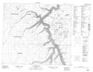
Maps showing Loon Creek, 33-84-17-W4, Alberta
Loon Creek is a River located in 33-84-17-W4, Alberta and has an elevation of 547 meters.
- Latitude: 56° 19' 30'' North (decimal: 56.3249999)
- Longitude: 112° 36' 43'' West (decimal: -112.6119443)
- Topography Feature Category: River
- Geographical Feature: Creek
- Canadian Province/Territory: Alberta
- Elevation: 547 meters
- Location: 33-84-17-W4
- Atlas of Canada Locator Map: Loon Creek
- GPS Coordinate Locator Map: Loon Creek Lat/Long
Loon Creek NTS Map Sheets