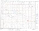
Maps showing Lost Lake, 14-17-W4, Alberta
Lost Lake is a Lake located in 14-17-W4, Alberta and has an elevation of 784 meters.
- Latitude: 50° 8' 52'' North (decimal: 50.1477778)
- Longitude: 112° 18' 5'' West (decimal: -112.3013889)
- Topography Feature Category: Lake
- Geographical Feature: Lake
- Canadian Province/Territory: Alberta
- Elevation: 784 meters
- Location: 14-17-W4
- Atlas of Canada Locator Map: Lost Lake
- GPS Coordinate Locator Map: Lost Lake Lat/Long