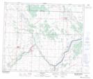
Maps showing Lostpoint Lake, 56,57-23-W4, Alberta
Lostpoint Lake is a Lake located in 56,57-23-W4, Alberta and has an elevation of 654 meters.
- Latitude: 53° 52' 48'' North (decimal: 53.8799999)
- Longitude: 113° 16' 51'' West (decimal: -113.2808333)
- Topography Feature Category: Lake
- Geographical Feature: Lake
- Canadian Province/Territory: Alberta
- Elevation: 654 meters
- Location: 56,57-23-W4
- Atlas of Canada Locator Map: Lostpoint Lake
- GPS Coordinate Locator Map: Lostpoint Lake Lat/Long