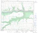
Maps showing Lothrop, 29-80-1-W6, Alberta
Lothrop is a Unincorporated area located in 29-80-1-W6, Alberta and has an elevation of 588 meters.
- Latitude: 55° 57' 23'' North (decimal: 55.9563889)
- Longitude: 118° 7' 51'' West (decimal: -118.1308332)
- Topography Feature Category: Unincorporated area
- Geographical Feature: Locality
- Canadian Province/Territory: Alberta
- Elevation: 588 meters
- Location: 29-80-1-W6
- Atlas of Canada Locator Map: Lothrop
- GPS Coordinate Locator Map: Lothrop Lat/Long
Lothrop NTS Map Sheets