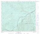
Maps showing Pass Creek, 35-60-20-W5, Alberta
Pass Creek is a Unincorporated area located in 35-60-20-W5, Alberta.
- Latitude: 54° 13' 52'' North (decimal: 54.2311111)
- Longitude: 116° 54' 12'' West (decimal: -116.9033332)
- Topography Feature Category: Unincorporated area
- Geographical Feature: Railway Point
- Canadian Province/Territory: Alberta
- Location: 35-60-20-W5
- Atlas of Canada Locator Map: Pass Creek
- GPS Coordinate Locator Map: Pass Creek Lat/Long
Pass Creek NTS Map Sheets