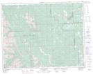
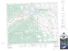
Maps showing Pinetop Hill, 24-6-W5, Alberta
Pinetop Hill is a Mountain located in 24-6-W5, Alberta and has an elevation of 1561 meters.
- Latitude: 51° 0' 31'' North (decimal: 51.0086110)
- Longitude: 114° 44' 10'' West (decimal: -114.7361110)
- Topography Feature Category: Mountain
- Geographical Feature: Hill
- Canadian Province/Territory: Alberta
- Elevation: 1561 meters
- Location: 24-6-W5
- Atlas of Canada Locator Map: Pinetop Hill
- GPS Coordinate Locator Map: Pinetop Hill Lat/Long
Pinetop Hill NTS Map Sheets