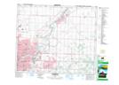
Maps showing Riverbend, 15-54-23-W4, Alberta
Riverbend is a Unincorporated area located in 15-54-23-W4, Alberta and has an elevation of 635 meters.
- Latitude: 53° 40' 6'' North (decimal: 53.6683332)
- Longitude: 113° 18' 2'' West (decimal: -113.3005556)
- Topography Feature Category: Unincorporated area
- Geographical Feature: Urban Community
- Canadian Province/Territory: Alberta
- Elevation: 635 meters
- Location: 15-54-23-W4
- Atlas of Canada Locator Map: Riverbend
- GPS Coordinate Locator Map: Riverbend Lat/Long