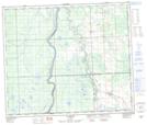
Maps showing Flatbush Creek, 10-66-2-W5, Alberta
Flatbush Creek is a River located in 10-66-2-W5, Alberta and has an elevation of 620 meters.
- Latitude: 54° 42' 10'' North (decimal: 54.7027777)
- Longitude: 114° 13' 33'' West (decimal: -114.2258333)
- Topography Feature Category: River
- Geographical Feature: Creek
- Canadian Province/Territory: Alberta
- Elevation: 620 meters
- Location: 10-66-2-W5
- Atlas of Canada Locator Map: Flatbush Creek
- GPS Coordinate Locator Map: Flatbush Creek Lat/Long
Flatbush Creek NTS Map Sheets