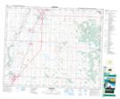
Maps showing Fleming Slough, 35-36-28-W4, Alberta
Fleming Slough is a Lake located in 35-36-28-W4, Alberta and has an elevation of 895 meters.
- Latitude: 52° 8' 7'' North (decimal: 52.1352777)
- Longitude: 113° 53' 19'' West (decimal: -113.8886110)
- Topography Feature Category: Lake
- Geographical Feature: Slough
- Canadian Province/Territory: Alberta
- Elevation: 895 meters
- Location: 35-36-28-W4
- Atlas of Canada Locator Map: Fleming Slough
- GPS Coordinate Locator Map: Fleming Slough Lat/Long