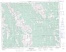
Maps showing Fording Pass, 16-6-W5, Alberta
Fording Pass is a Valley located in 16-6-W5, Alberta and has an elevation of 2290 meters.
- Latitude: 50° 19' 18'' North (decimal: 50.3216666)
- Longitude: 114° 47' 34'' West (decimal: -114.7927777)
- Topography Feature Category: Valley
- Geographical Feature: Pass
- Canadian Province/Territory: Alberta
- Elevation: 2290 meters
- Location: 16-6-W5
- Atlas of Canada Locator Map: Fording Pass
- GPS Coordinate Locator Map: Fording Pass Lat/Long
Fording Pass NTS Map Sheets