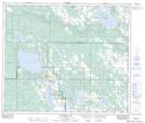
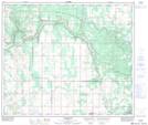
Maps showing Fork Creek, 31-62-10-W4, Alberta
Fork Creek is a River located in 31-62-10-W4, Alberta and has an elevation of 567 meters.
- Latitude: 54° 24' 28'' North (decimal: 54.4077777)
- Longitude: 111° 28' 56'' West (decimal: -111.4822221)
- Topography Feature Category: River
- Geographical Feature: Creek
- Canadian Province/Territory: Alberta
- Elevation: 567 meters
- Location: 31-62-10-W4
- Atlas of Canada Locator Map: Fork Creek
- GPS Coordinate Locator Map: Fork Creek Lat/Long
Fork Creek NTS Map Sheets