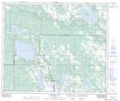
Maps showing Fork Lake, 19-63-11-W4, Alberta
Fork Lake is a Unincorporated area located in 19-63-11-W4, Alberta and has an elevation of 590 meters.
- Latitude: 54° 28' 20'' North (decimal: 54.4722221)
- Longitude: 111° 37' 18'' West (decimal: -111.6216666)
- Topography Feature Category: Unincorporated area
- Geographical Feature: Locality
- Canadian Province/Territory: Alberta
- Elevation: 590 meters
- Location: 19-63-11-W4
- Atlas of Canada Locator Map: Fork Lake
- GPS Coordinate Locator Map: Fork Lake Lat/Long
Fork Lake NTS Map Sheets