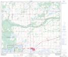
Maps showing Forsyth Lake, 62-6,7-W4, Alberta
Forsyth Lake is a Lake located in 62-6,7-W4, Alberta and has an elevation of 547 meters.
- Latitude: 54° 20' 4'' North (decimal: 54.3344444)
- Longitude: 110° 53' 28'' West (decimal: -110.8911110)
- Topography Feature Category: Lake
- Geographical Feature: Lake
- Canadian Province/Territory: Alberta
- Elevation: 547 meters
- Location: 62-6,7-W4
- Atlas of Canada Locator Map: Forsyth Lake
- GPS Coordinate Locator Map: Forsyth Lake Lat/Long
Forsyth Lake NTS Map Sheets