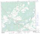
Maps showing Fort Assiniboine, 1-62-6-W5, Alberta
Fort Assiniboine is a Unincorporated area located in 1-62-6-W5, Alberta and has an elevation of 622 meters.
- Latitude: 54° 20' 3'' North (decimal: 54.3342000)
- Longitude: 114° 46' 29'' West (decimal: -114.7747000)
- Topography Feature Category: Unincorporated area
- Geographical Feature: Locality
- Canadian Province/Territory: Alberta
- Elevation: 622 meters
- Location: 1-62-6-W5
- Atlas of Canada Locator Map: Fort Assiniboine
- GPS Coordinate Locator Map: Fort Assiniboine Lat/Long
Fort Assiniboine NTS Map Sheets