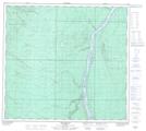
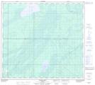
Maps showing Fort Hills, 96,97-10-W4, Alberta
Fort Hills is a Mountain located in 96,97-10-W4, Alberta and has an elevation of 310 meters.
- Latitude: 57° 22' 13'' North (decimal: 57.3702777)
- Longitude: 111° 31' 27'' West (decimal: -111.5241667)
- Topography Feature Category: Mountain
- Geographical Feature: Hills
- Canadian Province/Territory: Alberta
- Elevation: 310 meters
- Location: 96,97-10-W4
- Atlas of Canada Locator Map: Fort Hills
- GPS Coordinate Locator Map: Fort Hills Lat/Long
Fort Hills NTS Map Sheets