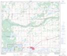
Maps showing Fort Kent, 25-61-5-W4, Alberta
Fort Kent is a Unincorporated area located in 25-61-5-W4, Alberta and has an elevation of 551 meters.
- Latitude: 54° 18' 39'' North (decimal: 54.3108333)
- Longitude: 110° 36' 16'' West (decimal: -110.6044443)
- Topography Feature Category: Unincorporated area
- Geographical Feature: Hamlet
- Canadian Province/Territory: Alberta
- Elevation: 551 meters
- Location: 25-61-5-W4
- Atlas of Canada Locator Map: Fort Kent
- GPS Coordinate Locator Map: Fort Kent Lat/Long
Fort Kent NTS Map Sheets