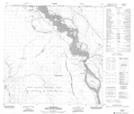
Maps showing Fort Smith Settlement, 126-11-W4, Alberta
Fort Smith Settlement is a Geographical area located in 126-11-W4, Alberta.
- Latitude: 59° 59' 21'' North (decimal: 59.9891667)
- Longitude: 111° 50' 34'' West (decimal: -111.8427777)
- Topography Feature Category: Geographical area
- Geographical Feature: Settlement
- Canadian Province/Territory: Alberta
- Location: 126-11-W4
- Atlas of Canada Locator Map: Fort Smith Settlement
- GPS Coordinate Locator Map: Fort Smith Settlement Lat/Long
Fort Smith Settlement NTS Map Sheets