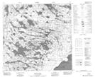
Maps showing Fallingsand Point, 118-1-W4, Alberta
Fallingsand Point is a Cape located in 118-1-W4, Alberta and has an elevation of 210 meters.
- Latitude: 59° 15' 45'' North (decimal: 59.2624999)
- Longitude: 110° 6' 15'' West (decimal: -110.1041667)
- Topography Feature Category: Cape
- Geographical Feature: Point
- Canadian Province/Territory: Alberta
- Elevation: 210 meters
- Location: 118-1-W4
- Atlas of Canada Locator Map: Fallingsand Point
- GPS Coordinate Locator Map: Fallingsand Point Lat/Long
Fallingsand Point NTS Map Sheets