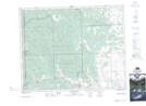
Maps showing Foster Hills, 29-5-W5, Alberta
Foster Hills is a Mountain located in 29-5-W5, Alberta and has an elevation of 1331 meters.
- Latitude: 51° 28' 23'' North (decimal: 51.4730555)
- Longitude: 114° 41' 46'' West (decimal: -114.6961110)
- Topography Feature Category: Mountain
- Geographical Feature: Hills
- Canadian Province/Territory: Alberta
- Elevation: 1331 meters
- Location: 29-5-W5
- Atlas of Canada Locator Map: Foster Hills
- GPS Coordinate Locator Map: Foster Hills Lat/Long
Foster Hills NTS Map Sheets