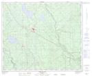
Maps showing Fox Creek, 32-62-19-W5, Alberta
Fox Creek is a Town located in 32-62-19-W5, Alberta and has an elevation of 826 meters.
- Latitude: 54° 23' 39'' North (decimal: 54.3941666)
- Longitude: 116° 48' 24'' West (decimal: -116.8066667)
- Topography Feature Category: Town
- Geographical Feature: Town
- Canadian Province/Territory: Alberta
- Elevation: 826 meters
- Location: 32-62-19-W5
- Atlas of Canada Locator Map: Fox Creek
- GPS Coordinate Locator Map: Fox Creek Lat/Long
Fox Creek NTS Map Sheets