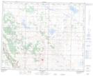
Maps showing Lowden Lake, 36,37-19-W4, Alberta
Lowden Lake is a Lake located in 36,37-19-W4, Alberta and has an elevation of 822 meters.
- Latitude: 52° 8' 38'' North (decimal: 52.1438889)
- Longitude: 112° 41' 21'' West (decimal: -112.6891666)
- Topography Feature Category: Lake
- Geographical Feature: Lake
- Canadian Province/Territory: Alberta
- Elevation: 822 meters
- Location: 36,37-19-W4
- Atlas of Canada Locator Map: Lowden Lake
- GPS Coordinate Locator Map: Lowden Lake Lat/Long
Lowden Lake NTS Map Sheets