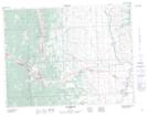
Maps showing Lundbreck Falls, 28-7-2-W5, Alberta
Lundbreck Falls is a Falls located in 28-7-2-W5, Alberta.
- Latitude: 49° 34' 56'' North (decimal: 49.5822222)
- Longitude: 114° 12' 31'' West (decimal: -114.2086111)
- Topography Feature Category: Falls
- Geographical Feature: Falls
- Canadian Province/Territory: Alberta
- Location: 28-7-2-W5
- Atlas of Canada Locator Map: Lundbreck Falls
- GPS Coordinate Locator Map: Lundbreck Falls Lat/Long