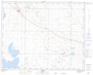
Maps showing Lure, 9-37-11-W4, Alberta
Lure is a Unincorporated area located in 9-37-11-W4, Alberta and has an elevation of 768 meters.
- Latitude: 52° 9' 41'' North (decimal: 52.1613888)
- Longitude: 111° 30' 24'' West (decimal: -111.5066667)
- Topography Feature Category: Unincorporated area
- Geographical Feature: Locality
- Canadian Province/Territory: Alberta
- Elevation: 768 meters
- Location: 9-37-11-W4
- Atlas of Canada Locator Map: Lure
- GPS Coordinate Locator Map: Lure Lat/Long