Maps showing Lychnis Mountain, 29-14-W5, Alberta
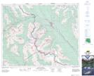
Lychnis Mountain is a Mountain located in 29-14-W5, Alberta and has an elevation of 2864 meters.
- Latitude: 51° 28' 55'' North (decimal: 51.4819444)
- Longitude: 115° 58' 10'' West (decimal: -115.9694443)
- Topography Feature Category: Mountain
- Geographical Feature: Mountain
- Canadian Province/Territory: Alberta
- Elevation: 2864 meters
- Location: 29-14-W5
- Atlas of Canada Locator Map: Lychnis Mountain
- GPS Coordinate Locator Map: Lychnis Mountain Lat/Long
Lychnis Mountain NTS Map Sheets