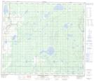
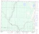
Maps showing Lyle Lake, 72-17-W4, Alberta
Lyle Lake is a Lake located in 72-17-W4, Alberta and has an elevation of 557 meters.
- Latitude: 55° 13' 32'' North (decimal: 55.2255555)
- Longitude: 112° 30' 6'' West (decimal: -112.5016666)
- Topography Feature Category: Lake
- Geographical Feature: Lake
- Canadian Province/Territory: Alberta
- Elevation: 557 meters
- Location: 72-17-W4
- Atlas of Canada Locator Map: Lyle Lake
- GPS Coordinate Locator Map: Lyle Lake Lat/Long
Lyle Lake NTS Map Sheets