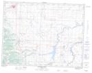
Maps showing Lynch Lakes, 22-5-30-W4, Alberta
Lynch Lakes is a Lake located in 22-5-30-W4, Alberta and has an elevation of 1344 meters.
- Latitude: 49° 23' 56'' North (decimal: 49.3988888)
- Longitude: 113° 57' 19'' West (decimal: -113.9552778)
- Topography Feature Category: Lake
- Geographical Feature: Lakes
- Canadian Province/Territory: Alberta
- Elevation: 1344 meters
- Location: 22-5-30-W4
- Atlas of Canada Locator Map: Lynch Lakes
- GPS Coordinate Locator Map: Lynch Lakes Lat/Long
Lynch Lakes NTS Map Sheets