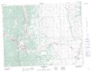
Maps showing Lyons Creek, 35-7-4-W5, Alberta
Lyons Creek is a River located in 35-7-4-W5, Alberta and has an elevation of 1537 meters.
- Latitude: 49° 36' 33'' North (decimal: 49.6091666)
- Longitude: 114° 25' 52'' West (decimal: -114.4311110)
- Topography Feature Category: River
- Geographical Feature: Creek
- Canadian Province/Territory: Alberta
- Elevation: 1537 meters
- Location: 35-7-4-W5
- Atlas of Canada Locator Map: Lyons Creek
- GPS Coordinate Locator Map: Lyons Creek Lat/Long