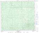
Maps showing Mabel Creek, 71-11-W5, Alberta
Mabel Creek is a River located in 71-11-W5, Alberta and has an elevation of 740 meters.
- Latitude: 55° 8' 2'' North (decimal: 55.1338888)
- Longitude: 115° 41' 13'' West (decimal: -115.6869443)
- Topography Feature Category: River
- Geographical Feature: Creek
- Canadian Province/Territory: Alberta
- Elevation: 740 meters
- Location: 71-11-W5
- Atlas of Canada Locator Map: Mabel Creek
- GPS Coordinate Locator Map: Mabel Creek Lat/Long
Mabel Creek NTS Map Sheets