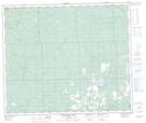
Maps showing MacIntosh Lake, 30-61-7-W5, Alberta
MacIntosh Lake is a Lake located in 30-61-7-W5, Alberta and has an elevation of 719 meters.
- Latitude: 54° 18' 17'' North (decimal: 54.3047222)
- Longitude: 115° 2' 7'' West (decimal: -115.0352778)
- Topography Feature Category: Lake
- Geographical Feature: Lake
- Canadian Province/Territory: Alberta
- Elevation: 719 meters
- Location: 30-61-7-W5
- Atlas of Canada Locator Map: MacIntosh Lake
- GPS Coordinate Locator Map: MacIntosh Lake Lat/Long
MacIntosh Lake NTS Map Sheets