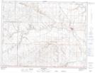
Maps showing Macklin Lake, 1-16-W4, Alberta
Macklin Lake is a Lake located in 1-16-W4, Alberta and has an elevation of 1048 meters.
- Latitude: 49° 2' 50'' North (decimal: 49.0472221)
- Longitude: 112° 1' 44'' West (decimal: -112.0288888)
- Topography Feature Category: Lake
- Geographical Feature: Lake
- Canadian Province/Territory: Alberta
- Elevation: 1048 meters
- Location: 1-16-W4
- Atlas of Canada Locator Map: Macklin Lake
- GPS Coordinate Locator Map: Macklin Lake Lat/Long
Macklin Lake NTS Map Sheets