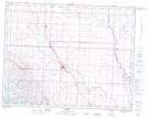
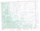
Maps showing MacMillan Creek, 8-17-29-W4, Alberta
MacMillan Creek is a River located in 8-17-29-W4, Alberta and has an elevation of 1076 meters.
- Latitude: 50° 24' 53'' North (decimal: 50.4147222)
- Longitude: 113° 57' 15'' West (decimal: -113.9541666)
- Topography Feature Category: River
- Geographical Feature: Creek
- Canadian Province/Territory: Alberta
- Elevation: 1076 meters
- Location: 8-17-29-W4
- Atlas of Canada Locator Map: MacMillan Creek
- GPS Coordinate Locator Map: MacMillan Creek Lat/Long
MacMillan Creek NTS Map Sheets