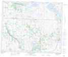
Maps showing Magee Lake, 27-41-24-W4, Alberta
Magee Lake is a Lake located in 27-41-24-W4, Alberta and has an elevation of 835 meters.
- Latitude: 52° 33' 40'' North (decimal: 52.5611111)
- Longitude: 113° 23' 9'' West (decimal: -113.3858332)
- Topography Feature Category: Lake
- Geographical Feature: Lake
- Canadian Province/Territory: Alberta
- Elevation: 835 meters
- Location: 27-41-24-W4
- Atlas of Canada Locator Map: Magee Lake
- GPS Coordinate Locator Map: Magee Lake Lat/Long
Magee Lake NTS Map Sheets