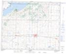
Maps showing Rochon Sands, 19-40-20-W4; 24,25-40-21-W4, Alberta
Rochon Sands is a Village located in 19-40-20-W4; 24,25-40-21-W4, Alberta and has an elevation of 796 meters.
- Latitude: 52° 27' 16'' North (decimal: 52.4544444)
- Longitude: 112° 52' 26'' West (decimal: -112.8738889)
- Topography Feature Category: Village
- Geographical Feature: Summer Village
- Canadian Province/Territory: Alberta
- Elevation: 796 meters
- Location: 19-40-20-W4; 24,25-40-21-W4
- Atlas of Canada Locator Map: Rochon Sands
- GPS Coordinate Locator Map: Rochon Sands Lat/Long