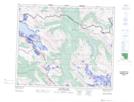
Maps showing Rockslide Creek, 52-9-W6, Alberta
Rockslide Creek is a River located in 52-9-W6, Alberta and has an elevation of 2007 meters.
- Latitude: 53° 29' 52'' North (decimal: 53.4978059)
- Longitude: 119° 15' 55'' West (decimal: -119.2651390)
- Topography Feature Category: River
- Geographical Feature: Creek
- Canadian Province/Territory: Alberta
- Elevation: 2007 meters
- Location: 52-9-W6
- Atlas of Canada Locator Map: Rockslide Creek
- GPS Coordinate Locator Map: Rockslide Creek Lat/Long
Rockslide Creek NTS Map Sheets