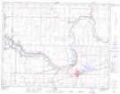
Maps showing Rocky Coulee, 10-24-W4, Alberta
Rocky Coulee is a Valley located in 10-24-W4, Alberta.
- Latitude: 49° 51' 4'' North (decimal: 49.8511110)
- Longitude: 113° 14' 4'' West (decimal: -113.2344443)
- Topography Feature Category: Valley
- Geographical Feature: Coulee
- Canadian Province/Territory: Alberta
- Location: 10-24-W4
- Atlas of Canada Locator Map: Rocky Coulee
- GPS Coordinate Locator Map: Rocky Coulee Lat/Long