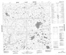
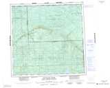
Maps showing Rocky Island Lake, 116,117-7-W5, Alberta
Rocky Island Lake is a Lake located in 116,117-7-W5, Alberta.
- Latitude: 59° 7' 48'' North (decimal: 59.1300000)
- Longitude: 115° 7' 36'' West (decimal: -115.1266667)
- Topography Feature Category: Lake
- Geographical Feature: Lake
- Canadian Province/Territory: Alberta
- Location: 116,117-7-W5
- Atlas of Canada Locator Map: Rocky Island Lake
- GPS Coordinate Locator Map: Rocky Island Lake Lat/Long
Rocky Island Lake NTS Map Sheets