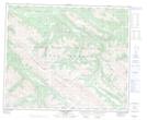
Maps showing Rocky Pass, 54-7-W6, Alberta
Rocky Pass is a Valley located in 54-7-W6, Alberta and has an elevation of 2095 meters.
- Latitude: 53° 38' 31'' North (decimal: 53.6419444)
- Longitude: 118° 55' 18'' West (decimal: -118.9216666)
- Topography Feature Category: Valley
- Geographical Feature: Pass
- Canadian Province/Territory: Alberta
- Elevation: 2095 meters
- Location: 54-7-W6
- Atlas of Canada Locator Map: Rocky Pass
- GPS Coordinate Locator Map: Rocky Pass Lat/Long
Rocky Pass NTS Map Sheets