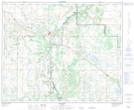
Maps showing Rom Hill, 43-8-W4, Alberta
Rom Hill is a Mountain located in 43-8-W4, Alberta and has an elevation of 677 meters.
- Latitude: 52° 44' 24'' North (decimal: 52.7399999)
- Longitude: 111° 7' 9'' West (decimal: -111.1191667)
- Topography Feature Category: Mountain
- Geographical Feature: Hill
- Canadian Province/Territory: Alberta
- Elevation: 677 meters
- Location: 43-8-W4
- Atlas of Canada Locator Map: Rom Hill
- GPS Coordinate Locator Map: Rom Hill Lat/Long
Rom Hill NTS Map Sheets