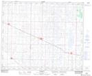
Maps showing Rosalind, 17-44-17-W4, Alberta
Rosalind is a Village located in 17-44-17-W4, Alberta and has an elevation of 712 meters.
- Latitude: 52° 47' 23'' North (decimal: 52.7897222)
- Longitude: 112° 26' 38'' West (decimal: -112.4438888)
- Topography Feature Category: Village
- Geographical Feature: Village
- Canadian Province/Territory: Alberta
- Elevation: 712 meters
- Location: 17-44-17-W4
- Atlas of Canada Locator Map: Rosalind
- GPS Coordinate Locator Map: Rosalind Lat/Long