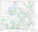
Maps showing Rosinan Lake, 8-57-8-W4, Alberta
Rosinan Lake is a Lake located in 8-57-8-W4, Alberta and has an elevation of 658 meters.
- Latitude: 53° 54' 50'' North (decimal: 53.9138888)
- Longitude: 111° 9' 59'' West (decimal: -111.1663888)
- Topography Feature Category: Lake
- Geographical Feature: Lake
- Canadian Province/Territory: Alberta
- Elevation: 658 meters
- Location: 8-57-8-W4
- Atlas of Canada Locator Map: Rosinan Lake
- GPS Coordinate Locator Map: Rosinan Lake Lat/Long