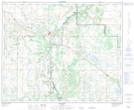
Maps showing Rosyth, 22-42-9-W4, Alberta
Rosyth is a Unincorporated area located in 22-42-9-W4, Alberta and has an elevation of 685 meters.
- Latitude: 52° 38' 17'' North (decimal: 52.6380555)
- Longitude: 111° 13' 27'' West (decimal: -111.2241666)
- Topography Feature Category: Unincorporated area
- Geographical Feature: Locality
- Canadian Province/Territory: Alberta
- Elevation: 685 meters
- Location: 22-42-9-W4
- Atlas of Canada Locator Map: Rosyth
- GPS Coordinate Locator Map: Rosyth Lat/Long
Rosyth NTS Map Sheets