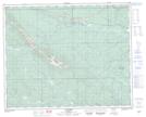
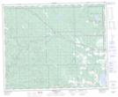
Maps showing Rough Creek, 39-11-W5, Alberta
Rough Creek is a River located in 39-11-W5, Alberta and has an elevation of 1276 meters.
- Latitude: 52° 23' 35'' North (decimal: 52.3930555)
- Longitude: 115° 28' 58'' West (decimal: -115.4827778)
- Topography Feature Category: River
- Geographical Feature: Creek
- Canadian Province/Territory: Alberta
- Elevation: 1276 meters
- Location: 39-11-W5
- Atlas of Canada Locator Map: Rough Creek
- GPS Coordinate Locator Map: Rough Creek Lat/Long
Rough Creek NTS Map Sheets