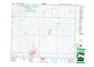
Maps showing Round Hill, 30-48-18-W4, Alberta
Round Hill is a Unincorporated area located in 30-48-18-W4, Alberta and has an elevation of 743 meters.
- Latitude: 53° 9' 55'' North (decimal: 53.1652777)
- Longitude: 112° 37' 51'' West (decimal: -112.6308333)
- Topography Feature Category: Unincorporated area
- Geographical Feature: Hamlet
- Canadian Province/Territory: Alberta
- Elevation: 743 meters
- Location: 30-48-18-W4
- Atlas of Canada Locator Map: Round Hill
- GPS Coordinate Locator Map: Round Hill Lat/Long