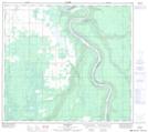
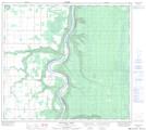
Maps showing Rousseau Creek, 13-91-22-W5, Alberta
Rousseau Creek is a River located in 13-91-22-W5, Alberta and has an elevation of 483 meters.
- Latitude: 56° 53' 49'' North (decimal: 56.8969444)
- Longitude: 117° 23' 43'' West (decimal: -117.3952778)
- Topography Feature Category: River
- Geographical Feature: Creek
- Canadian Province/Territory: Alberta
- Elevation: 483 meters
- Location: 13-91-22-W5
- Atlas of Canada Locator Map: Rousseau Creek
- GPS Coordinate Locator Map: Rousseau Creek Lat/Long
Rousseau Creek NTS Map Sheets