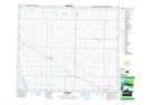
Maps showing Royal Park, 31-52-15-W4, Alberta
Royal Park is a Unincorporated area located in 31-52-15-W4, Alberta and has an elevation of 661 meters.
- Latitude: 53° 32' 24'' North (decimal: 53.5399999)
- Longitude: 112° 12' 14'' West (decimal: -112.2038888)
- Topography Feature Category: Unincorporated area
- Geographical Feature: Locality
- Canadian Province/Territory: Alberta
- Elevation: 661 meters
- Location: 31-52-15-W4
- Atlas of Canada Locator Map: Royal Park
- GPS Coordinate Locator Map: Royal Park Lat/Long